
 English
 Español
 Deutsch
 日本語
日本語 Polska
 Français
 中國
中國 한국의
한국의 Українська
 Italiano
 Nederlands
 Türkçe
 Português
 Bahasa Indonesia
 Русский
 हिंदी
हिंदी


- Formatos disponíveis: Stereolithography: stl 444.00 MB
- Coleção:No
- Largura em milímetros:339
- Altura em milímetros:1.6
- Profundidade em milímetros:149
- Pronto para impressão:
- Scan 3D:No
- Conteúdo adulto:No
- PBR:No
- Treinamento de IA:No
- Visualizações:1972
- Data: 2022-06-17
- ID do Item:402305
- Avaliação:
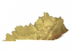
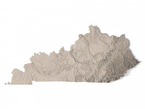
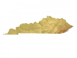
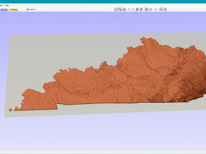
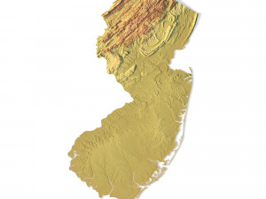
Create Detailed Kentucky Terrain Models with This High-Resolution 3D STL
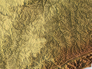
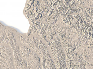
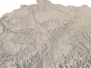
The Kentucky Topographic Map STL model offers a high-resolution depiction of the state’s topography and distinctive geographic features. This 3D model is perfect for crafting physical relief maps from materials such as wood, metal, plastic, or concrete. Whether used for landform visualization, educational purposes, or professional GIS projects, this model provides precise elevation data for accurate terrain modeling. Suitable for 3D printing, CNC machining, and laser engraving.
- File size: 704 MB / 506 MB
- Model size: 338.58 mm x 148.74 mm x 1.628 mm
- Resolution: 0,06 mm
- Projection: Mercator
- Scaling factor: X — 1; Y — 1; Z — 3
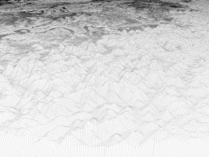
- Polygons: 14 778 224
- Vertices: 7 399 968
- Geometry: Polygonal Tris only
- Base: Open / Closed
Features of the Kentucky Topographic STL Model
Detailed elevation data capturing Kentucky’s hills, valleys, and diverse landforms.
Compatible with FDM/SLA 3D printers for creating detailed terrain models.
Designed for CNC machining to craft topographic maps from wood or metal.
Supports high-precision laser engraving for metal surface detailing.
Se precisar de um formato diferente, por favor abra um novo Support Ticket e solicite isso. Podemos converter modelos 3D para: .stl, .c4d, .obj, .fbx, .ma/.mb, .3ds, .3dm, .dxf/.dwg, .max. .blend, .skp, .glb. Não convertemos cenas 3D e formatos como .step, .iges, .stp, .sldprt.!
Download Kentucky Topographic Map STL Model Modelo de Impressão 3D stl De sychev23021983
usa state country america art kentucky mapItems relacionados De Kentucky Topographic Map STL Model


